
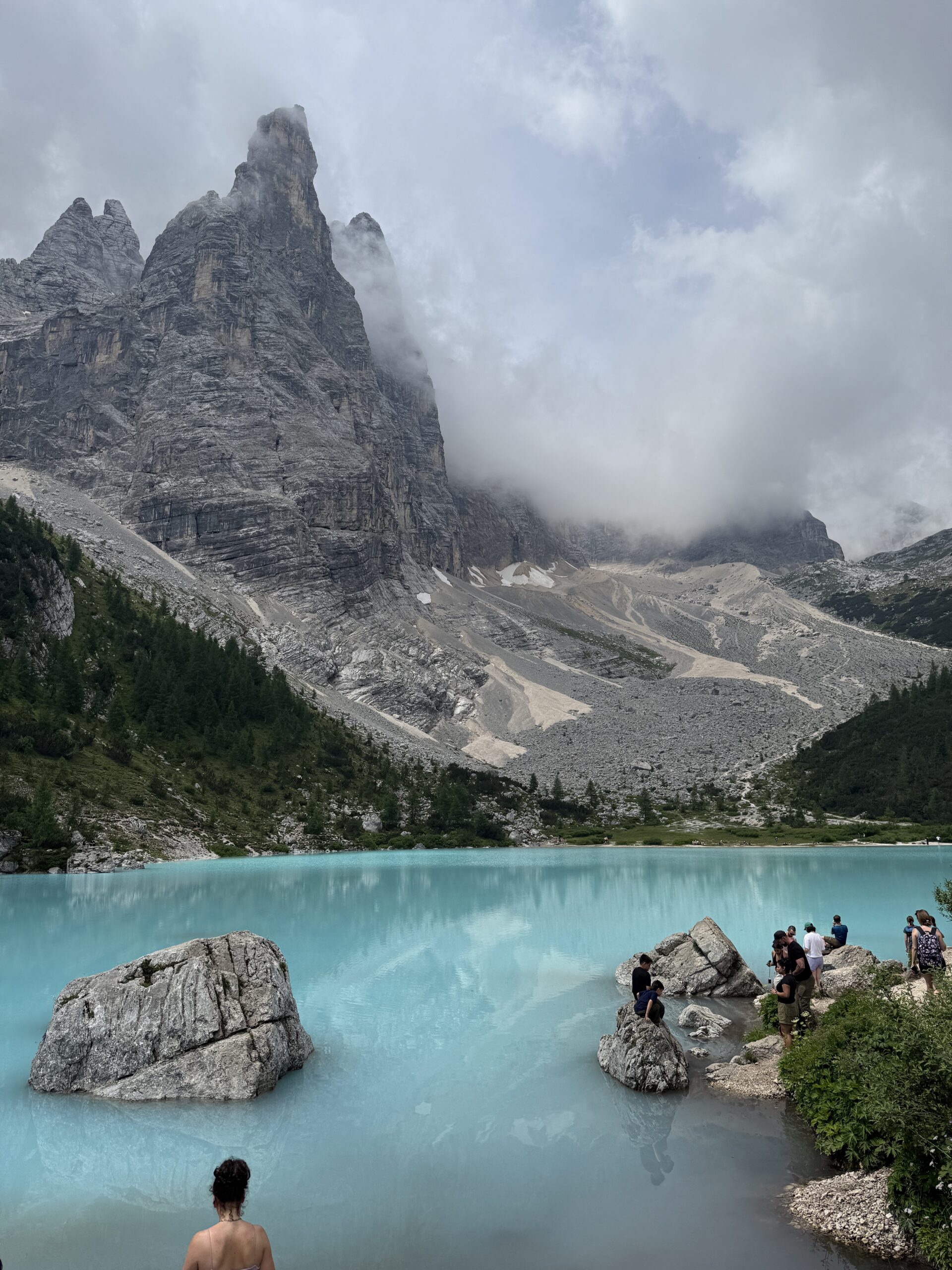
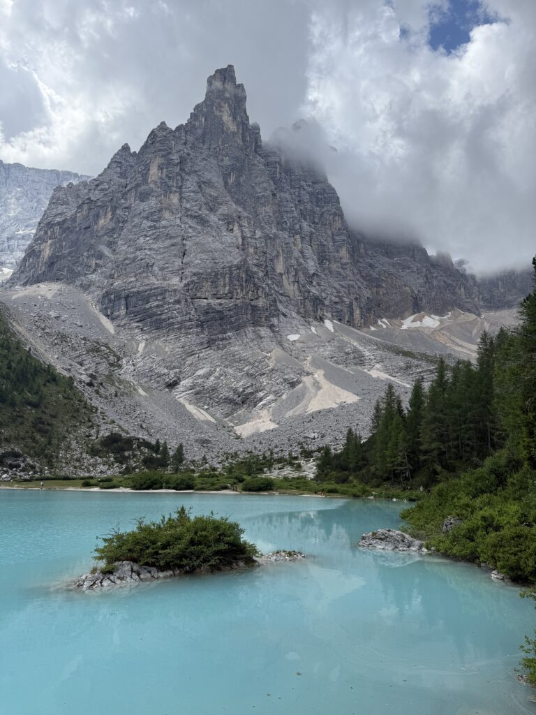
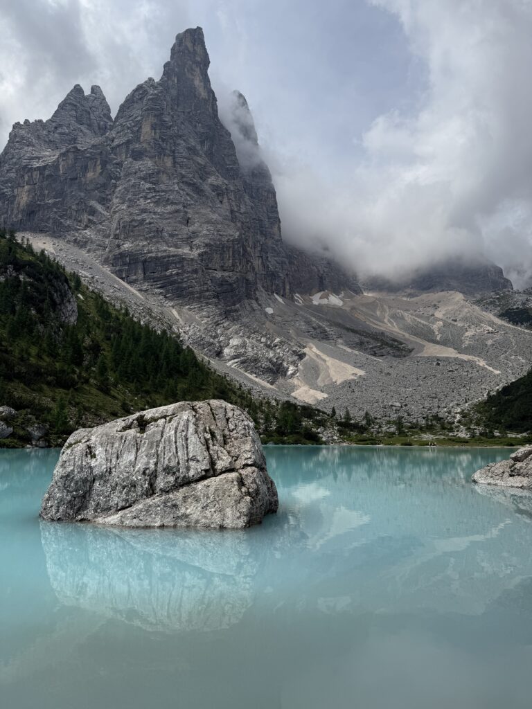
Lake Sorapis (Lago di Sorapis) is one of the most famous alpine lakes in the Dolomites, near Cortina d’Ampezzo in northern Italy. An iconic milky turquoise lake at 1,925 meters altitude, surrounded by dramatic jagged cliffs and the towering peak of Croda del Sorapis. It’s a hike-in-only lake (no road access) which makes it feel more remote and rewarding when you get there!
Our experience
Lake Sorapis Loop (12,7 km / ±5 hours)
Our adventure to Lago di Sorapis started when we parked our car at the trailhead (here). There’s free parking on the side of the road, but only a handful of spots. So definitely plan to arrive before 9am if you want a spot ahead of the masses.
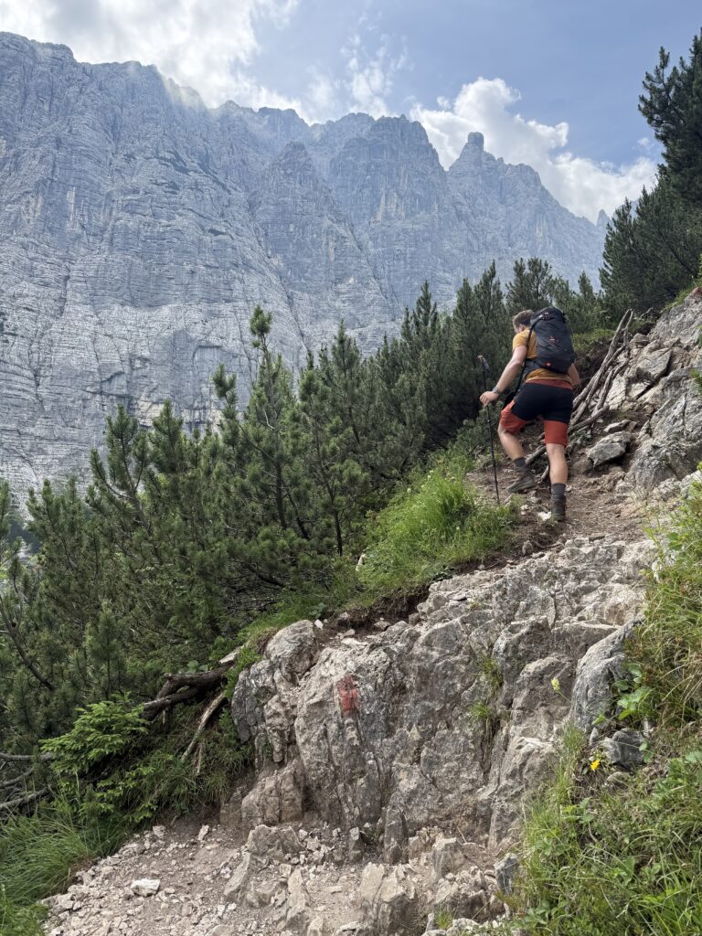
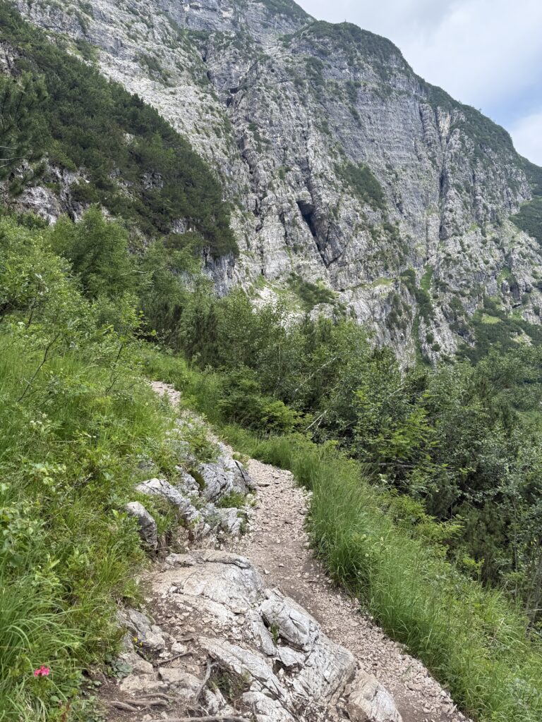
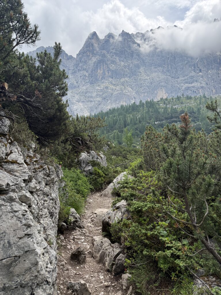
We followed Route 217 up, which immediately hits you with a pretty steep ascent. It’s a bit of a workout, but the path is clear and winds through forest with occasional views opening up to the Dolomites. Once you’ve pushed through the climb, the trail levels out a little, and you’re rewarded with some really beautiful scenery before you even reach the lake.
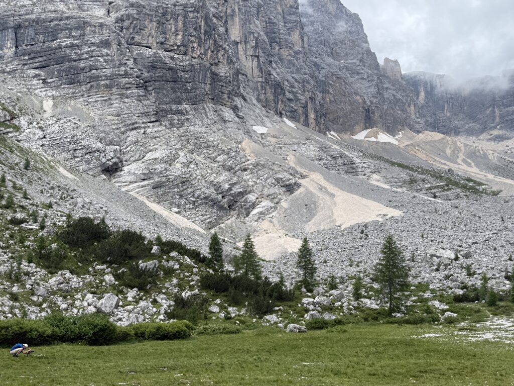
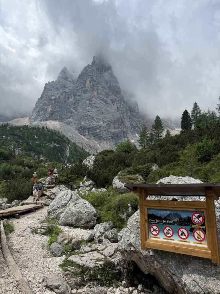
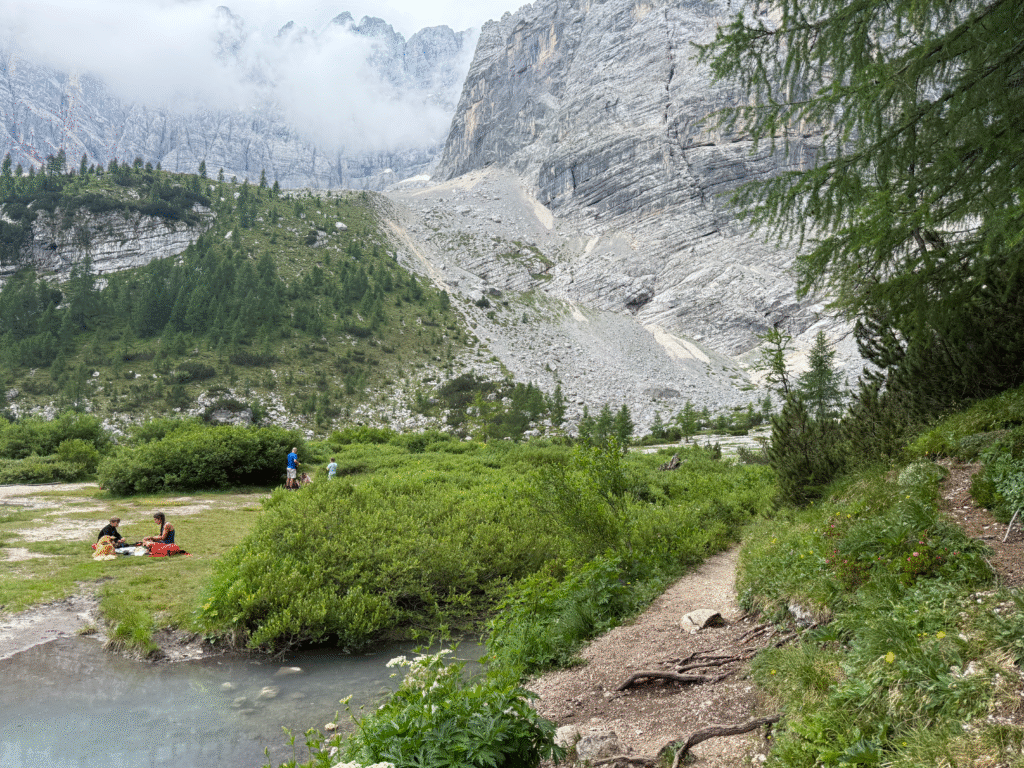
After about two hours we arrived at Lake Sorapis.. and wow. The color is unreal: that iconic milky turquoise against a backdrop of dramatic cliffs. We took our time here, walked the round around the lake for about 1 hour, and found a spot to just sit, snack, and soak it all in. There are plenty of places to rest, though not a lot of shade, so bring enough water and maybe even a hat. There is a cabin nearby, but we brought our own snacks. You could check out Rifugio Vandelli if you’re up for a terrace with a nice view. Tip: On the other side of the lake, there is a kind of beach-alike spot which is less crowded as everyone will sit on the side where you see the first glimpse of the lake. If you follow the Komoot link below (beware of the pass on the left side of the lake – that required a bit of hand-foot climbing, but there are also other routes you could follow).
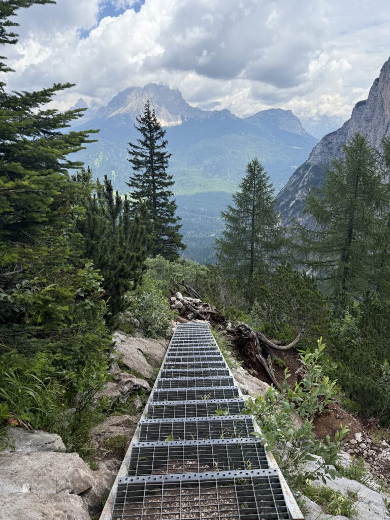
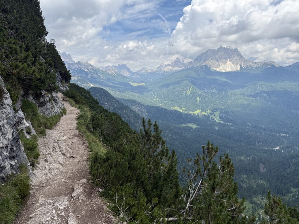
For the descent, we followed Route 215, which is narrower than the way up. The path hugs the slope in some parts, so keep an eye on your footing. It’s not overly technical, but you don’t want to stumble here. The views on this stretch, though, are stunning, with glimpses of valleys and peaks in the distance. Be extra careful if it has rained, as the rocks can get quite slippery. As you can see in the pictures, we had a cloudy day, but luckily made it back before the rain set in. Mountain weather can be unpredictable. One moment you’re in full sunshine, the next you might be facing a thunderstorm. So pack accordingly and check the weather forecast for the region.
In total, the hike took us around five hours, including breaks, photo stops, and the loop around the lake. It’s definitely one of those hikes where the journey and the destination are equally rewarding: a bit of challenge, a lot of beauty, and an unforgettable mountain lake at the top.
What to pack
- hiking poles (due to steep ascent and descent)
- Day backpack
- Lunch or snacks to enjoy at the lake
GPX Route
I’m a big fan of Komoot, so here you can find the route with distance, time, height differences all-in-one for this hike: