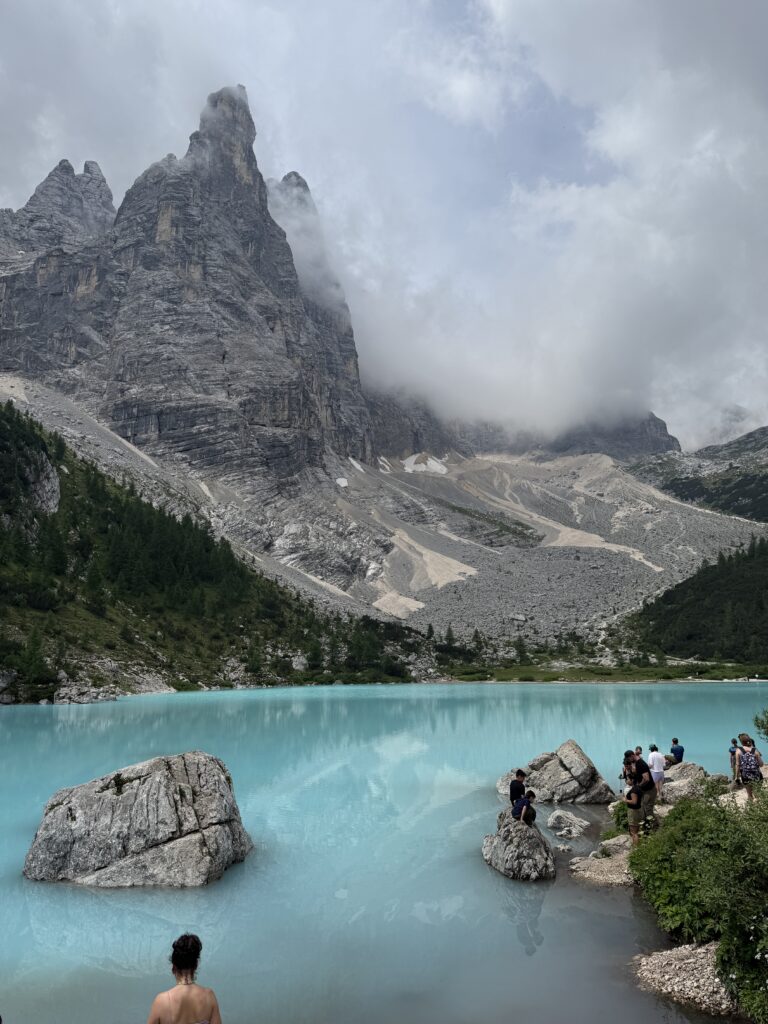
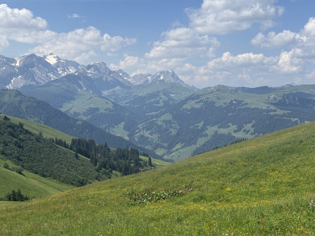
The Bärentrek is a hut-to-hut traverse of the Bernese Oberland, linking Meiringen to Lenk across six days of mountain passes, valley descents, and everything in between. This trek is the most popular section of the Via Alpina 1, a long-distance route that crosses the entire Swiss Alps. It covers 6 of the route’s 20 stages, showcasing stunning views of the Eiger, Mönch, and Jungfrau on your hike. We did it in the middle of a heatwave, which turned the trip into something wilder and more memorable than we expected. Snowfields became our best friends. So did every little mountain stream we could dunk our balaclavas into.
Our experience
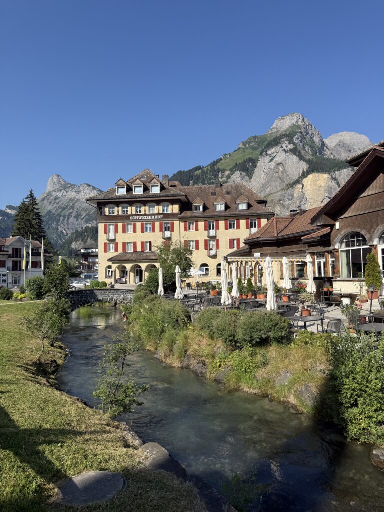
Day 1: Meiringen → Grindelwald (15 km / ±6h)
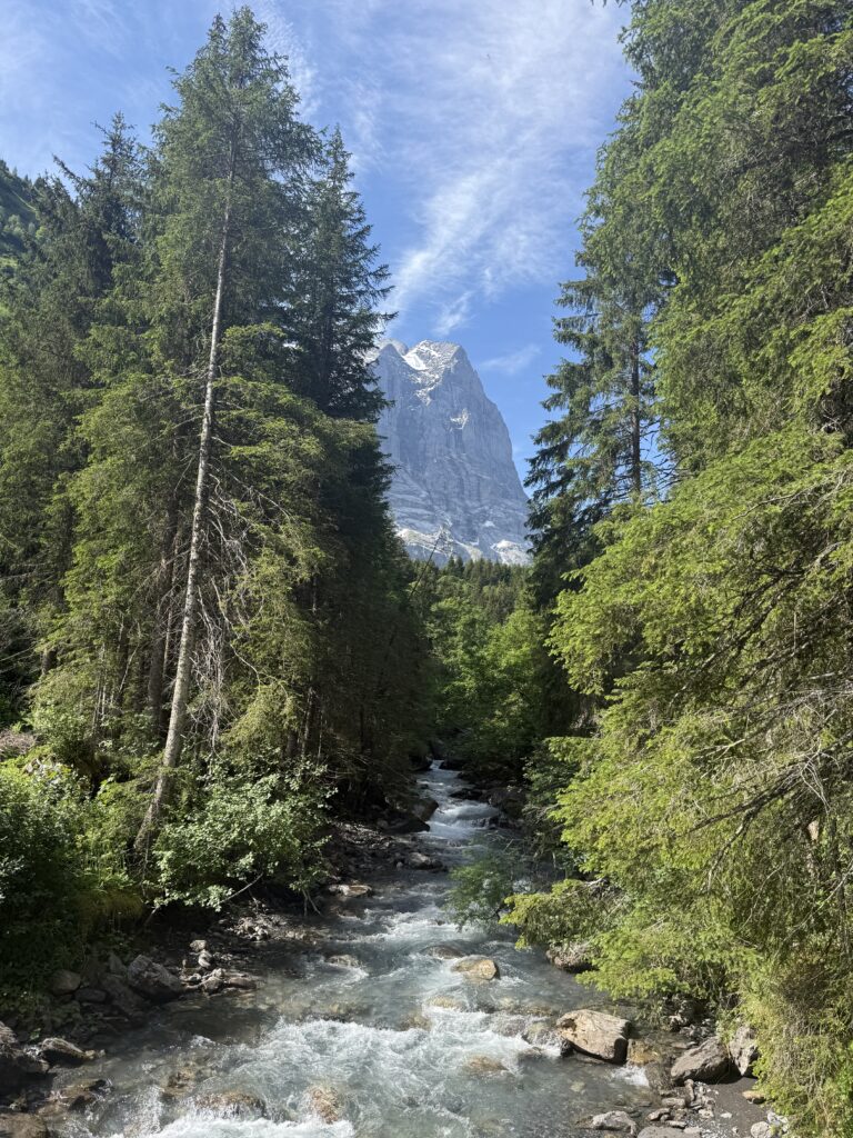
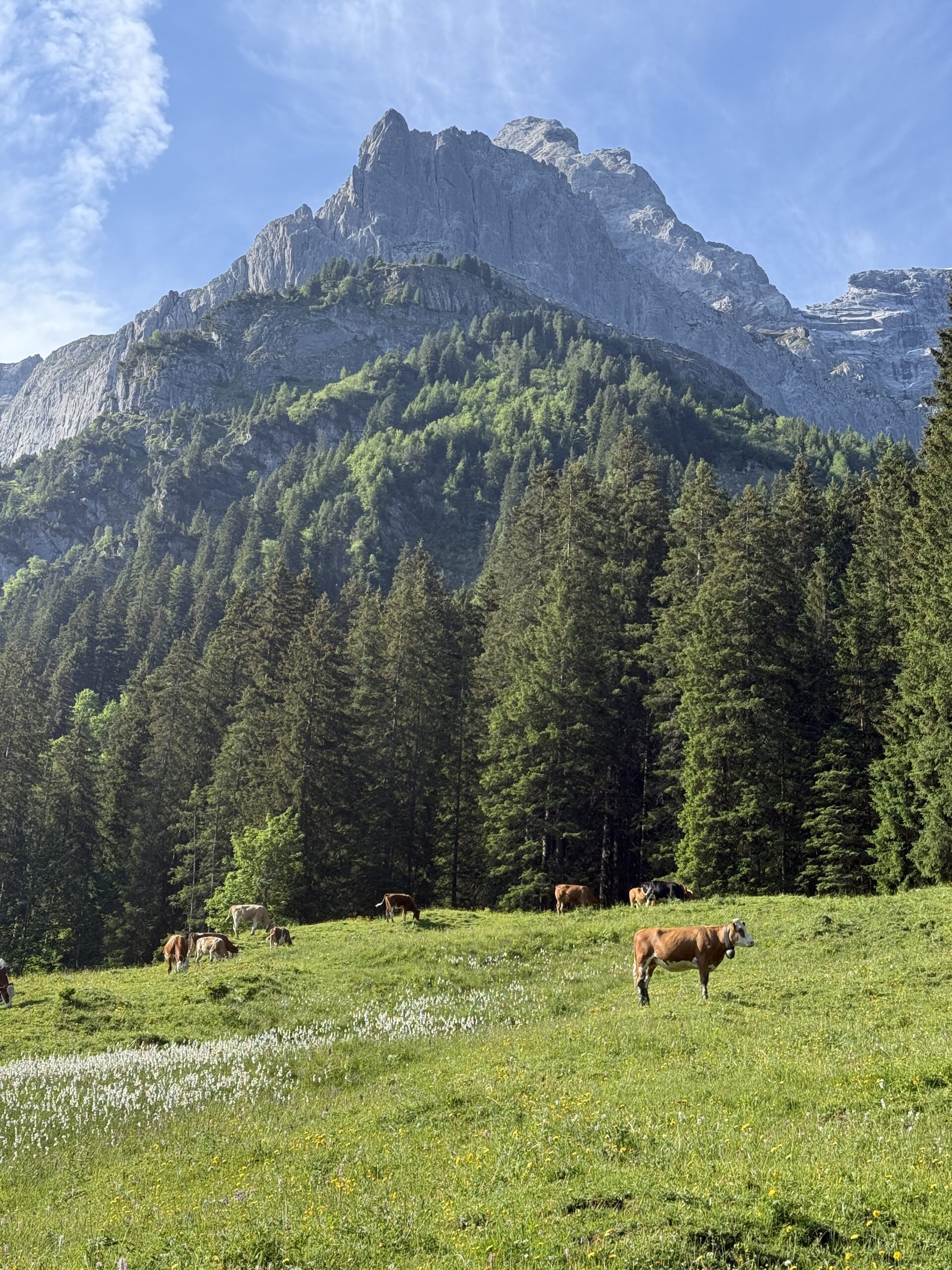
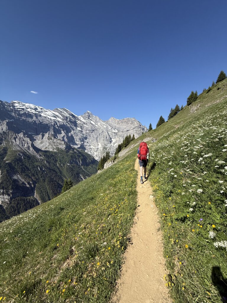
We left our car at Parking Center Meiringen for the week and took the bus to Rosenlaui, where the trail started for us. The trail picks up alongside a small river, winding through cool forest shade that we were grateful for even on day one, as a heatwave had settled over Europe that week. The path climbs steadily through forest and alpine meadow, with the Rosenlaui glacier gorge making an early and dramatic appearance. We hiked past a narrow limestone canyon with rushing water far below. As the trail rises higher, the Bernese giants start revealing themselves on the horizon. The Wetterhorn came first, then the Eiger and Mönch emerged behind it, one by one.
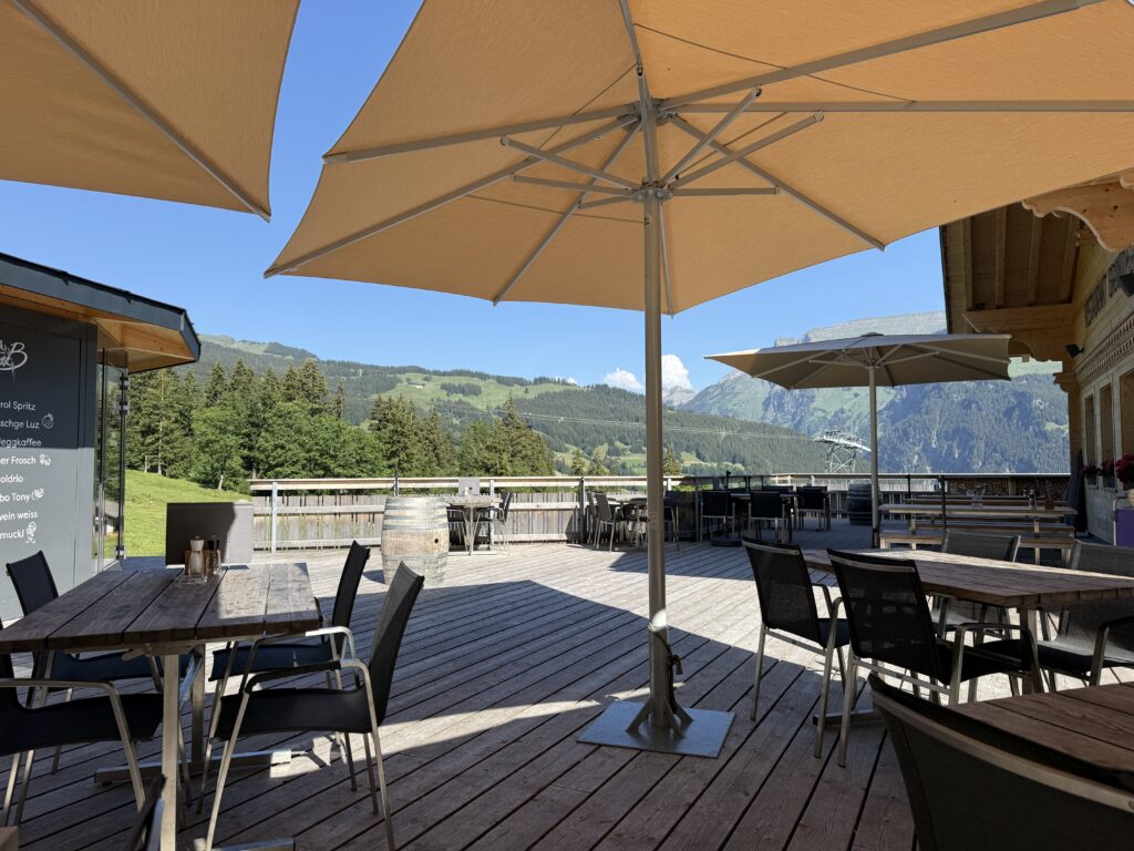
We stopped for drinks at Chalet-Hotel Schwarzwaldalp, a welcome pause before the final climb to the day’s high point. At the top, we enjoyed our packed lunch and some ice cream at the outdoor terrace of Berghotel Grosse Scheidegg. This is where the mountain bikers appear in numbers. The descent from here is something of a classic, so we watched them fly past while we happily ate our ice cream. The view down over the Grindelwald valley from the terrace is stunning. The descent was straightforward and beautiful. We ended the day at Naturfreunde Hostel Grindelwald, where we enjoyed the views on the mountains from the backyard.
Day 2: Grindelwald → Lauterbrunnen (18.5 km / ±7h)
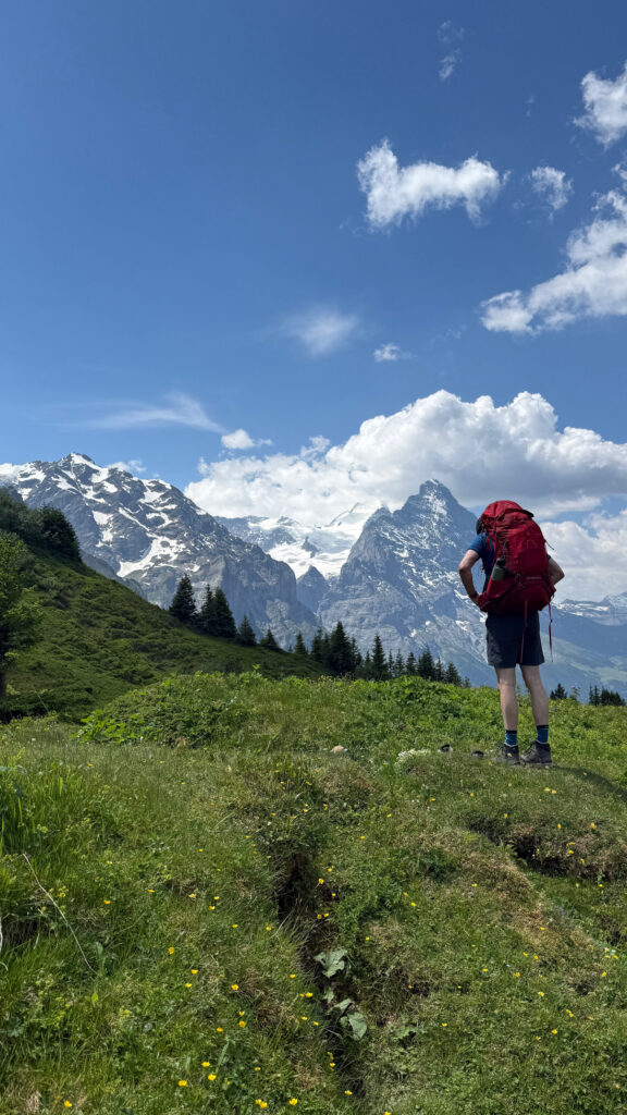
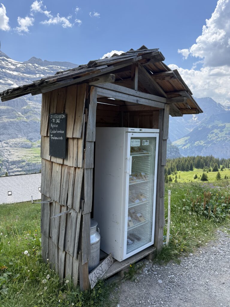
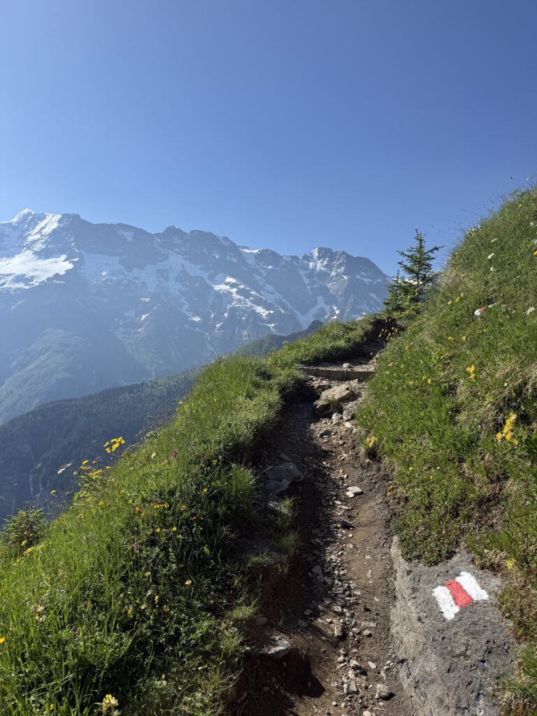
Today was a classic Bernese Oberland traverse, with the Eiger’s north face looming above us for much of the morning and the Jungfrau filling the skyline ahead. The path lead towards the Kleine Scheidegg, passing traditional wooden huts and cheese stands selling the famous local Alp cheese. This is the kind of scenery that makes you feel like you’ve walked into a postcard, right?!
We didn’t even make it to noon before stopping for ice cream at Bergrestaurant Brandegg, as the heat left us no choice. Don’t miss the local meringue while you’re there! It’s a Bernese Oberland classic and absolutely worth it.
The next section ahead was open, exposed, and steeply uphill. With the sun already at full strength, we made the easy decision to take the train one stop from Brandegg to Alpiglen. No regrets. From Alpiglen, we used every mountain stream we crossed as an opportunity to drench our balaclavas and keep the heat at bay. We stopped for lunch at Restaurant Eigernordwand. With a name like “Eiger North Face” and a terrace to match, it delivered exactly the views you’d hope for.
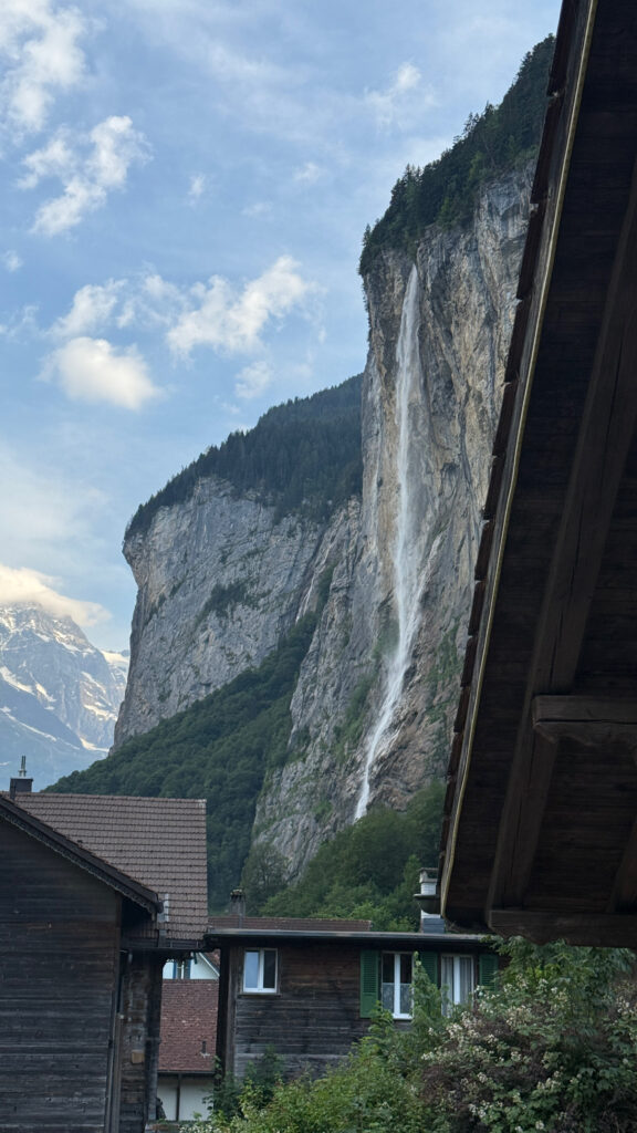
The descend went through Wengen, where we took the train down to Lauterbrunnen, to save the knees for the days ahead. Lauterbrunnen itself is one of those valley arrivals that is memorable: 72 waterfalls tumbling off sheer cliff faces, the Staubbach cascading straight down in front of you. We stayed at Hotel Schützen that night.
Day 3: Lauterbrunnen → Griesalp (16.2 km / ±8h)
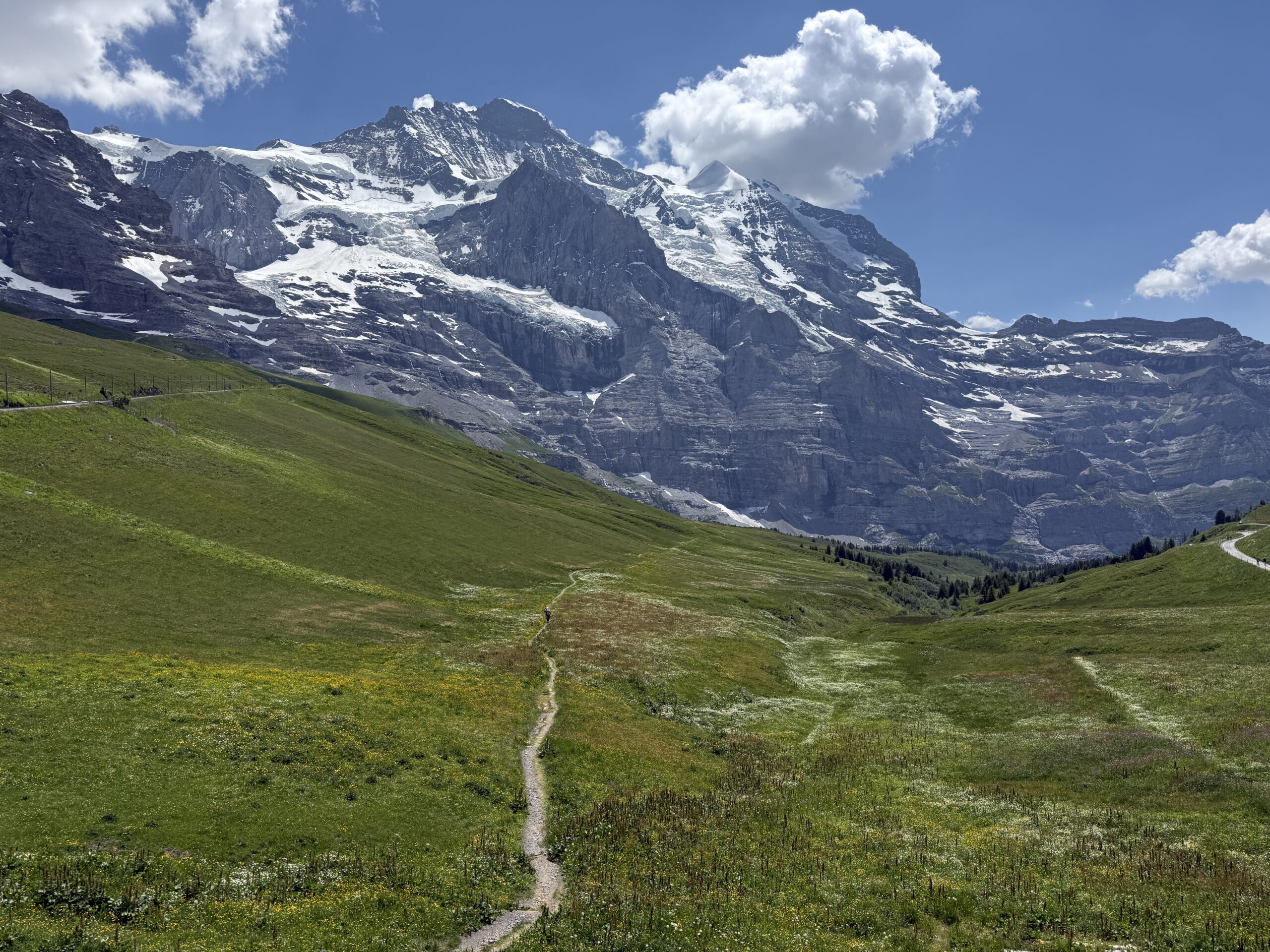
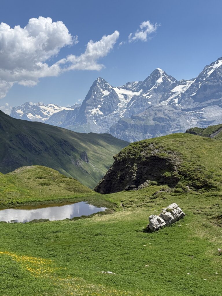
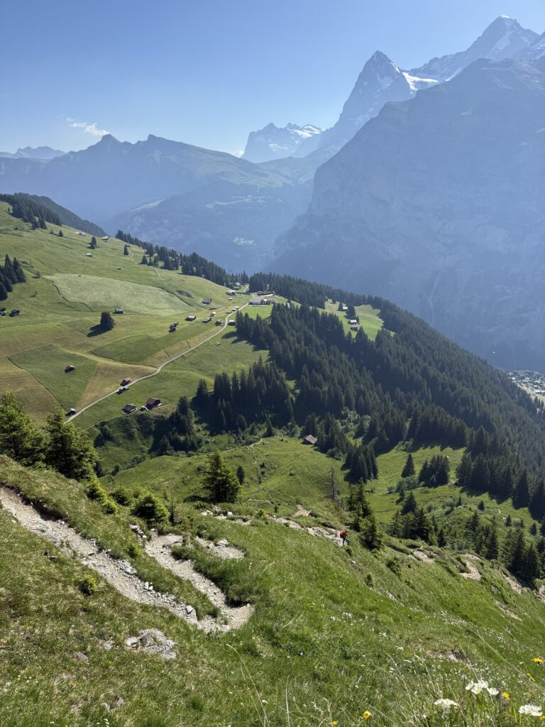
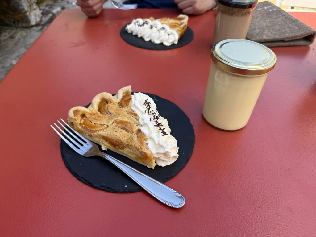
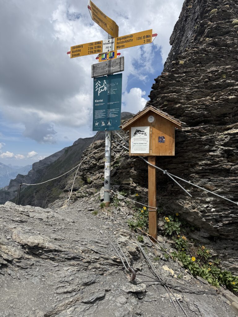
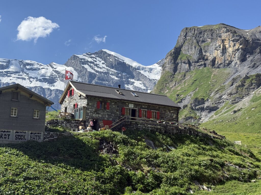
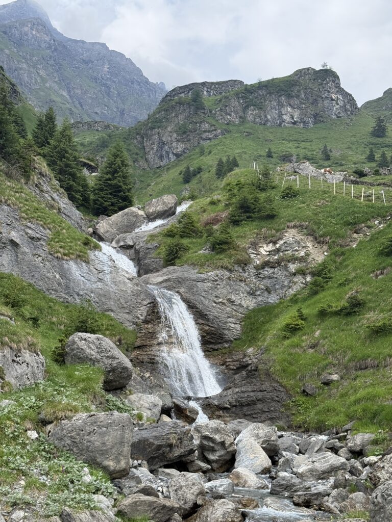
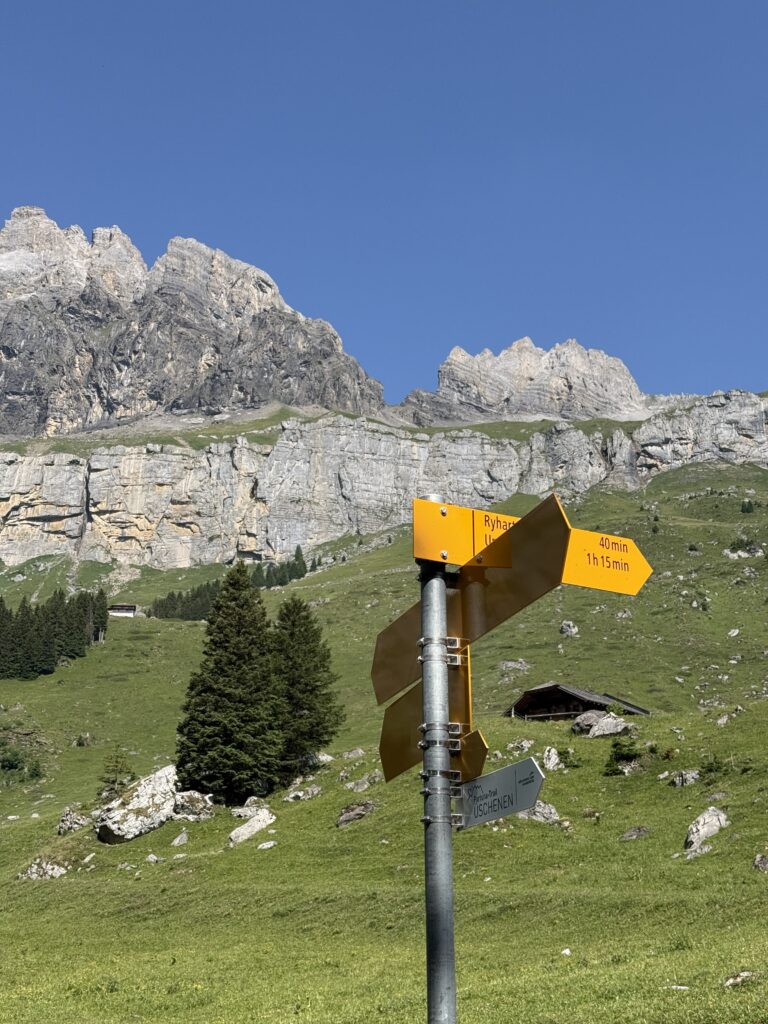
We took the bus and cable car from Lauterbrunnen up to Mürren to save time. Today would already clock in at around 8 hours of hiking, so every shortcut on the valley climb counted. From Mürren, the trail traverses high above the Lauterbrunnen valley with the Schilthorn ridge looming above you and a very long drop below. The heat was relentless on the open sections, but the trail kept rewarding us with cold streams at just the right moments. The scenery up here is something else. Wide open alpine landscape, the valley far below, the mountains all around. It carried us all the way to the Rotstockhütte, where we stopped for coffee and a slice of their homemade pie. Highly recommended.
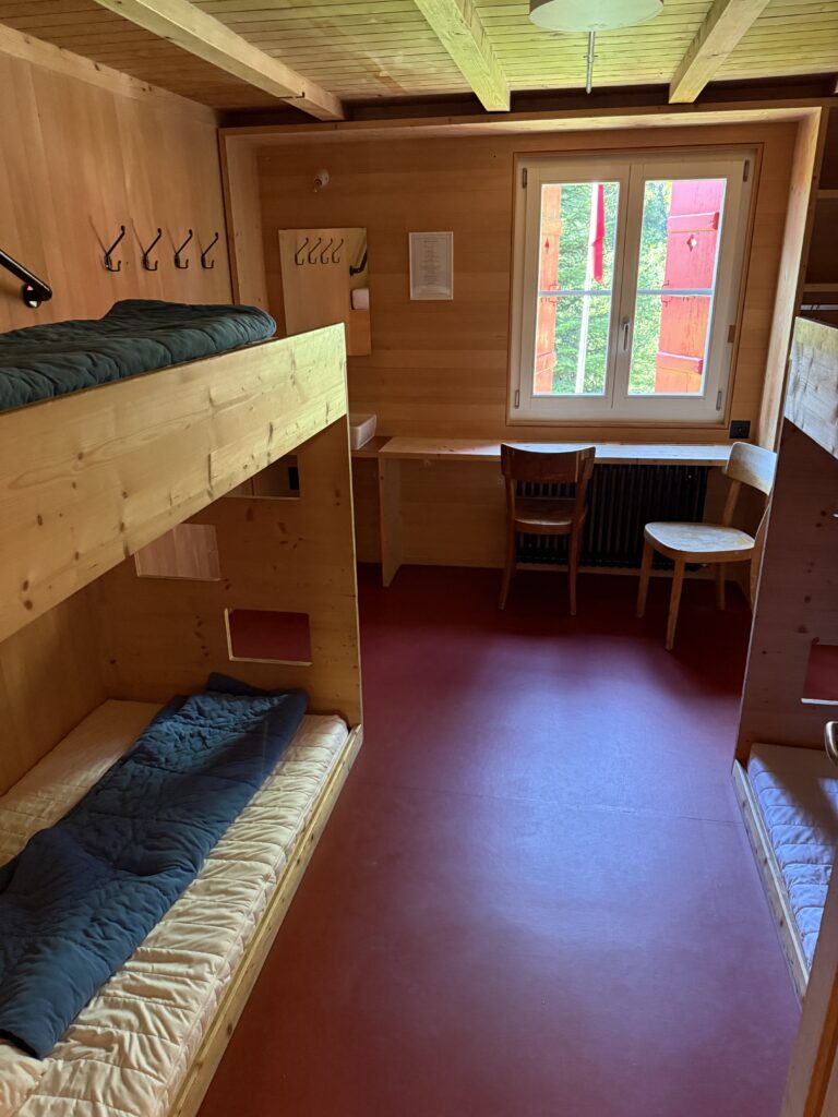
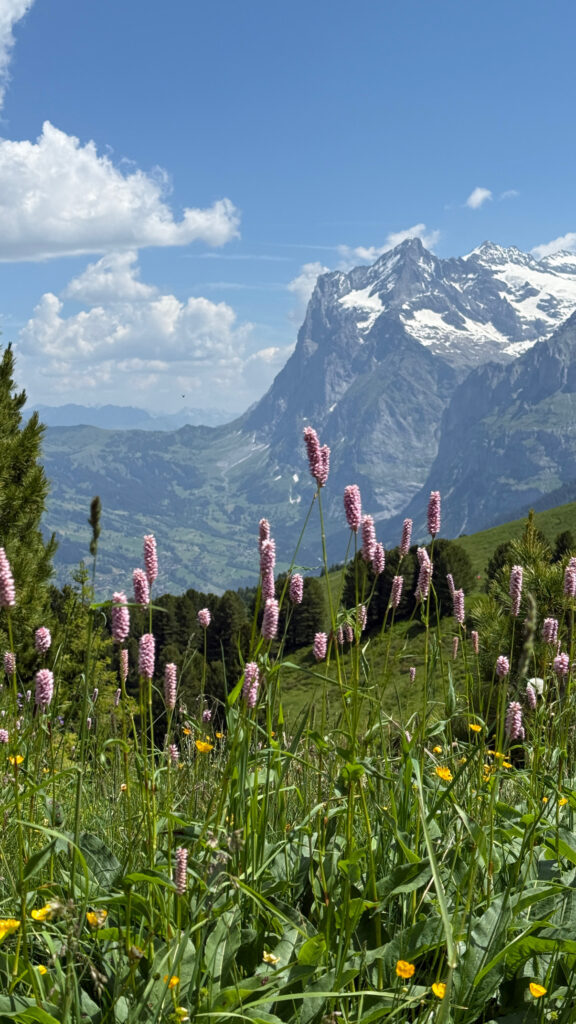
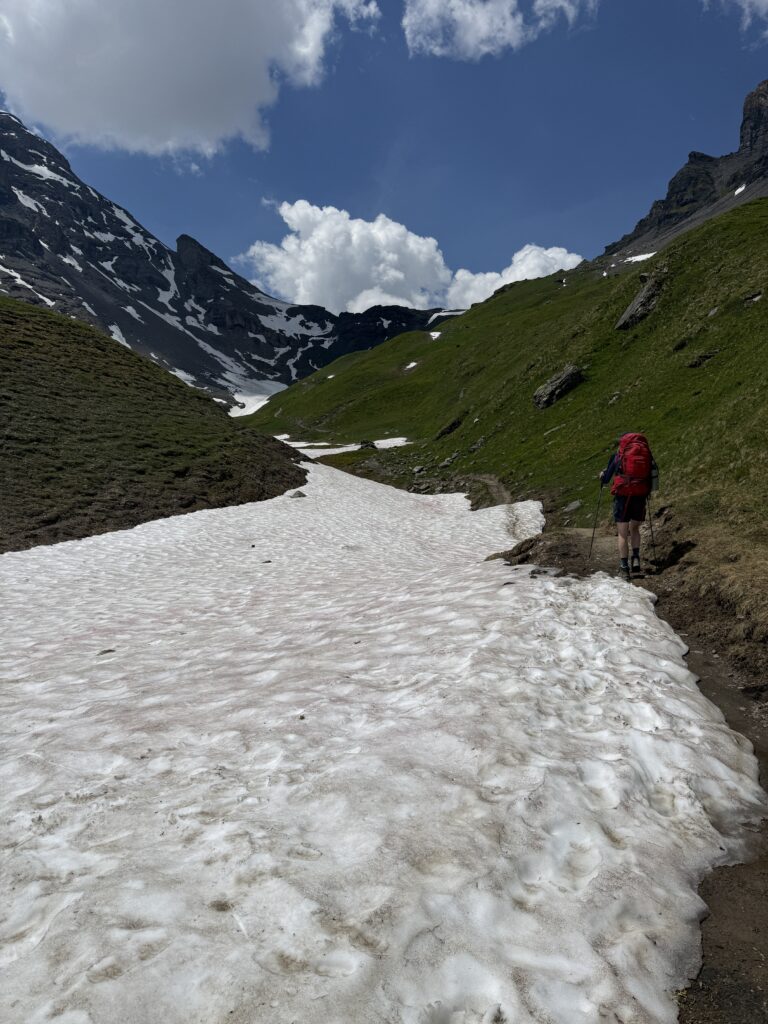
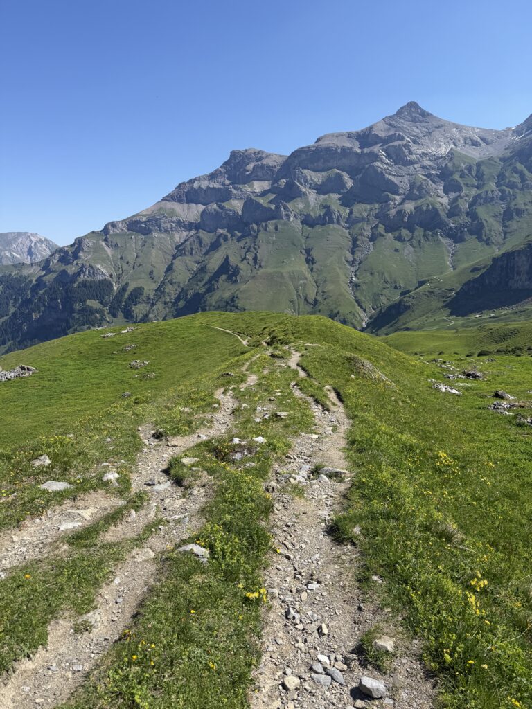
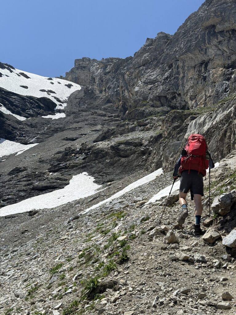
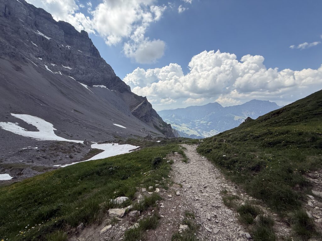
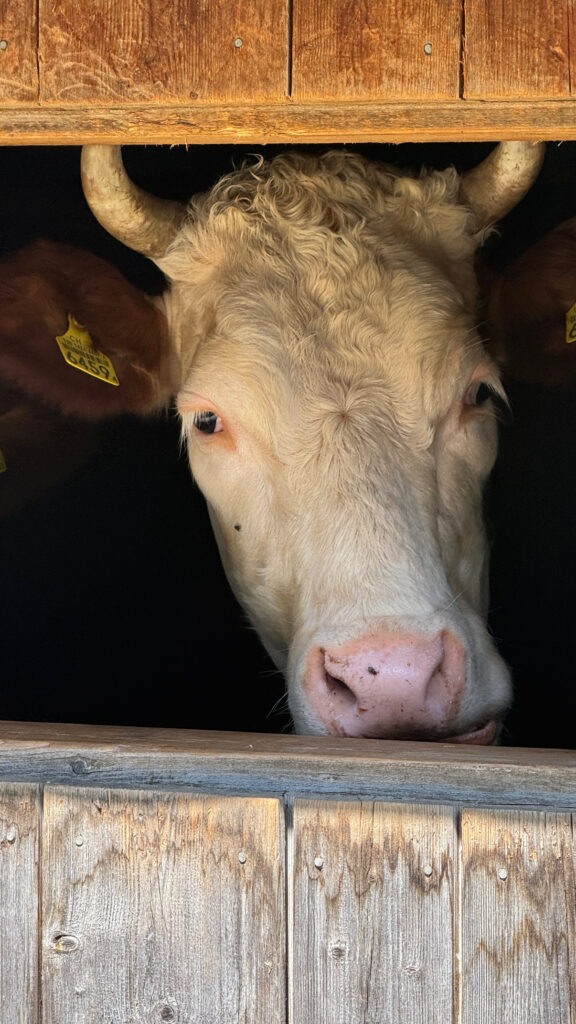
From there, the trail climbs to the Sefinenfurggepass. The pass itself delivers: sweeping views over the Kiental valley and the surrounding peaks, with the snowy Sefinenfurgge right in front of you. Hiking in mid-June, we crossed several snowfields on the way up. For us, it was a welcome escape from the heat! Then came the descent. A landslide just below the pass had taken out the stairs entirely, leaving us to improvise. We ended up sledging down on our bums until the path reappeared. Not exactly what we had planned, but honestly one of the more memorable moments of the trip. After picking our way through cow and goat fields, Griesalp finally came into view far below, tucked at the end of the Kiental valley. The thunder started rolling in on the final stretch, but we made it to our accommodation just in time. We stayed at Naturfreundehaus Gorneren, a beautiful 150-year-old mountain hut that serves dinner at 6PM sharp. So beware of the time, or you’ll miss it! 😉
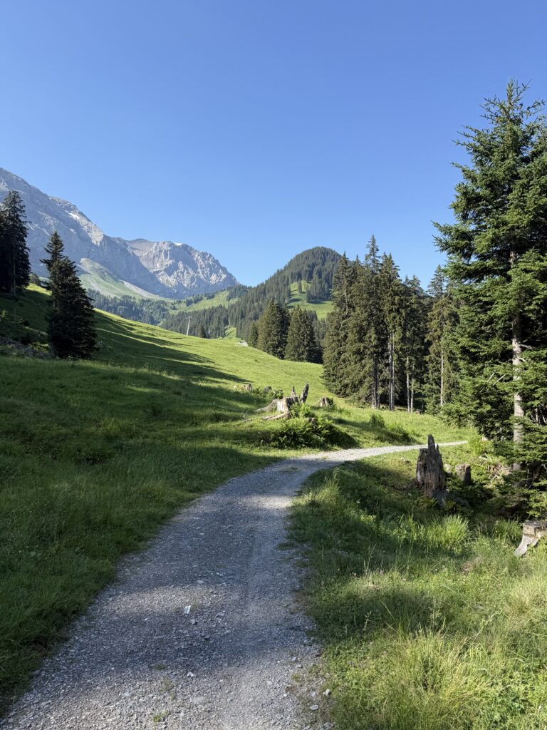
Day 4: Griesalp → Kandersteg (15 km / ±9h)
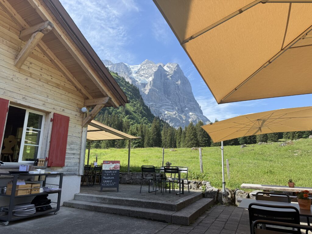
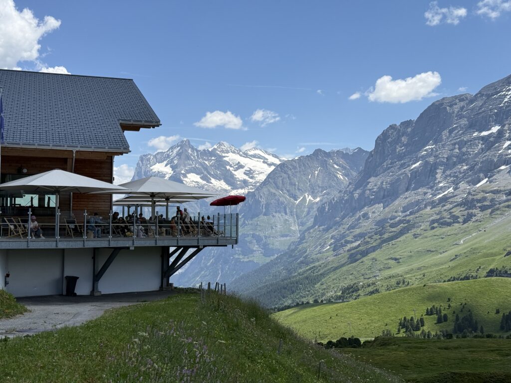
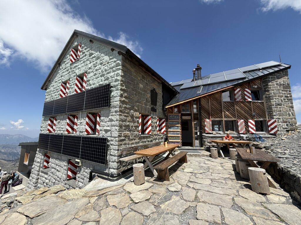
This stage takes you through the Swiss Alps UNESCO World Heritage area, and it earns that designation in every sense. The day starts gently enough, winding through a forested section before the valley opens up onto the Bundalp. A word of warning: the forest stretch comes with horse flies (Stechfliegen in German, you’ll know them when you meet them). Power through and reward yourself with a drink at Berghaus Bundalp, where you get your first proper look at the Blüemlisalphütte perched way up above you. Eyes on the prize.
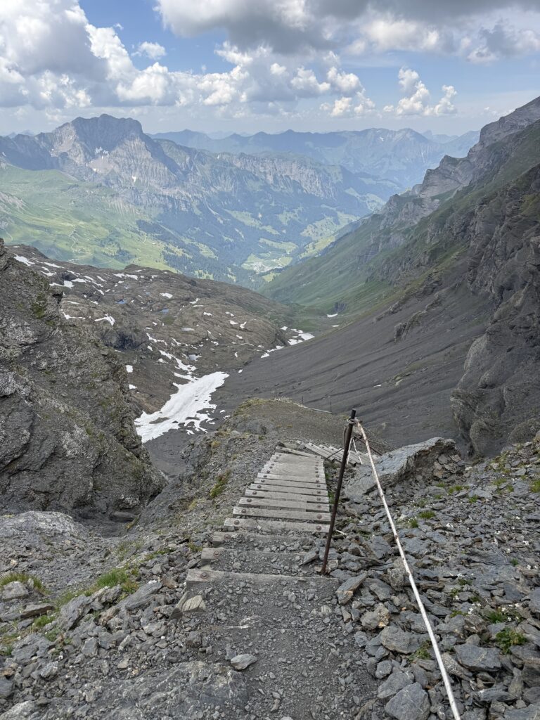
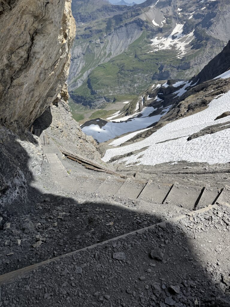
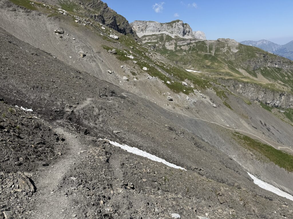
From Bundalp, the ascent to the Hohtürlipass is relentless: steep, exposed, and jaw-droppingly beautiful. On the way up, a section of improvised path made us slow down and pay attention. Recent landslide activity had left the footing uneven and the original trail partially gone. Nothing technical, but this is not the place to discover you don’t like heights.
We enjoyed some well deserved lunch at the Blüemlisalphütte, with an amazing view on both sides of the pass. I’d definitely recommend choosing the Kaiserschmarrn, it’s so yummy.
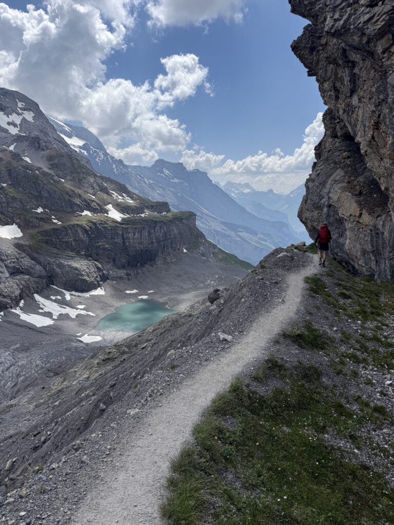
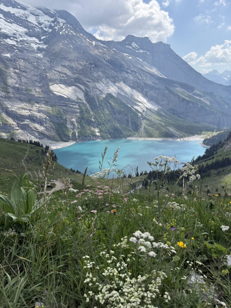
From there, the trail continues down to the Oeschinensee. The descend was in much better condition, luckily. And the view on the Oeschinensee from the top was magical. This glacial lake so blue it looks digitally enhanced. By the time we reached the cable car station, we were done for the day, ordered some icecream and took the cable car down to Kandersteg. Note: the last cable car down leaves at 6PM, so be on time (or you’ll have to walk for another 1,5 hours down to the village). We slept at the Belle Epoque Hotel Victoria (it has a pool, just so you know..).
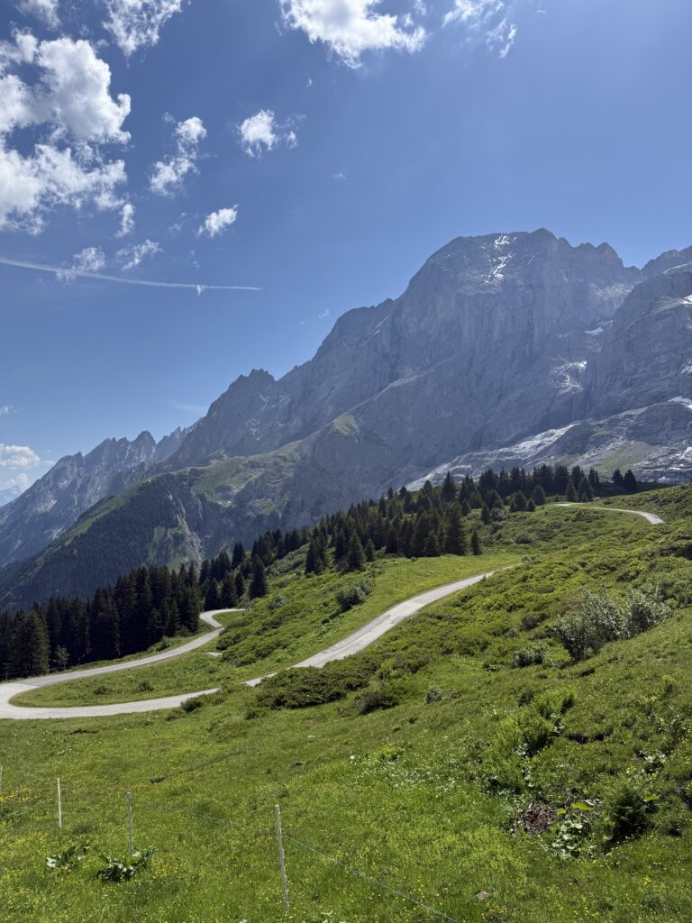
Day 5: Kandersteg → Adelboden (16,5 km / ±7,5h)
The day started with a gentle valley walk alongside a river. Then the valley ended, and the pass revealed itself: wide open, full sun, nowhere to hide. We could see exactly what was coming. We stopped for a refreshing drink at the Lohner mountain restaurant before tackling the climb. Partly for the energy, mostly for the courage. The ascent was tough but rewarding, with the kind of big open views that make you forget your legs are burning.
The descent is where this stage demands your full attention. Long sections of loose, slippery gravel that shift under your feet with every step. Sure-footedness is not optional here, and trekking poles earn their place. Halfway down, we rewarded ourselves with ice cream at Berghaus Bunderalp. One navigational note worth flagging: about 10 minutes before Berghaus Bunderalp, you’ll hit a T-junction. We believe the left turn is the newer and recommended route. The path we took straight ahead led us through sections of roped-off land that required some ungainly clambering.
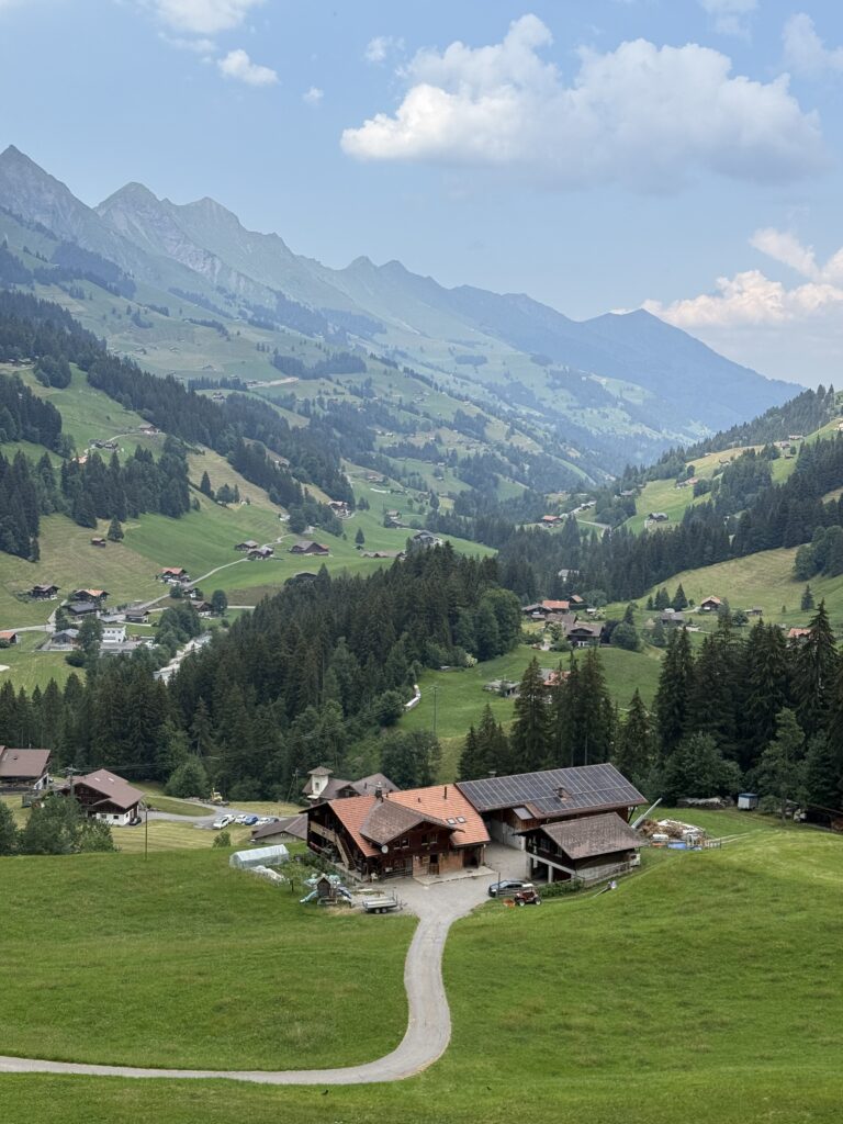
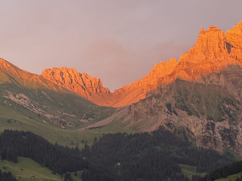
The reward was Adelboden. Beautiful cobbled streets, flower boxes on every window, and going out for dinner here was very much appreciated! We slept at Hotel Bristol and that evening I took a photo from our room: the pass we had crossed that day, glowing orange in the last light.
Day 6: Adelboden → Lenk (12 km / ±4h)
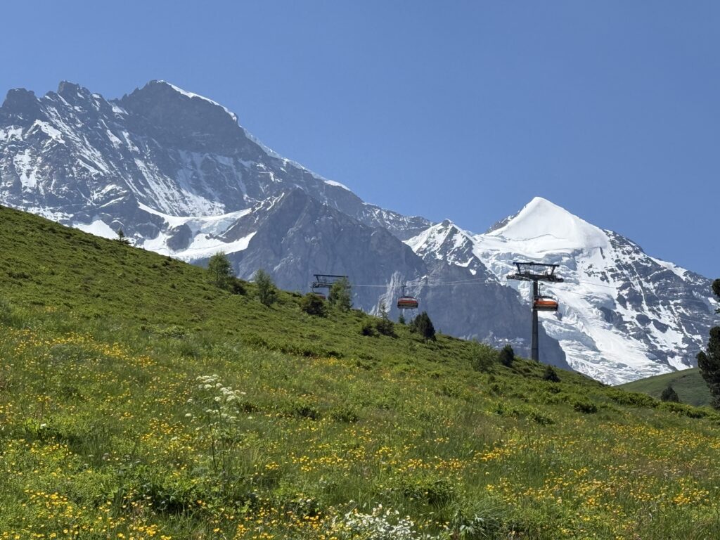
The easiest day has arrived! After five days across the Oberland, we were grateful for it. No brutal ascents, no scary staircases, just gentle valleys unfolding ahead of us. We could finally look up instead of watching your footing all the time. The hike started in the shade, with the cable cars surrounding us. Today, we walked in the skiarea of Adelboden-Lenk. We had a half-way stop at Restaurant Geilsbruggli before hiking to the top that day. The path is paved, so it’s easy on the feet, but unforgiving in the heat with no tree cover to speak of.
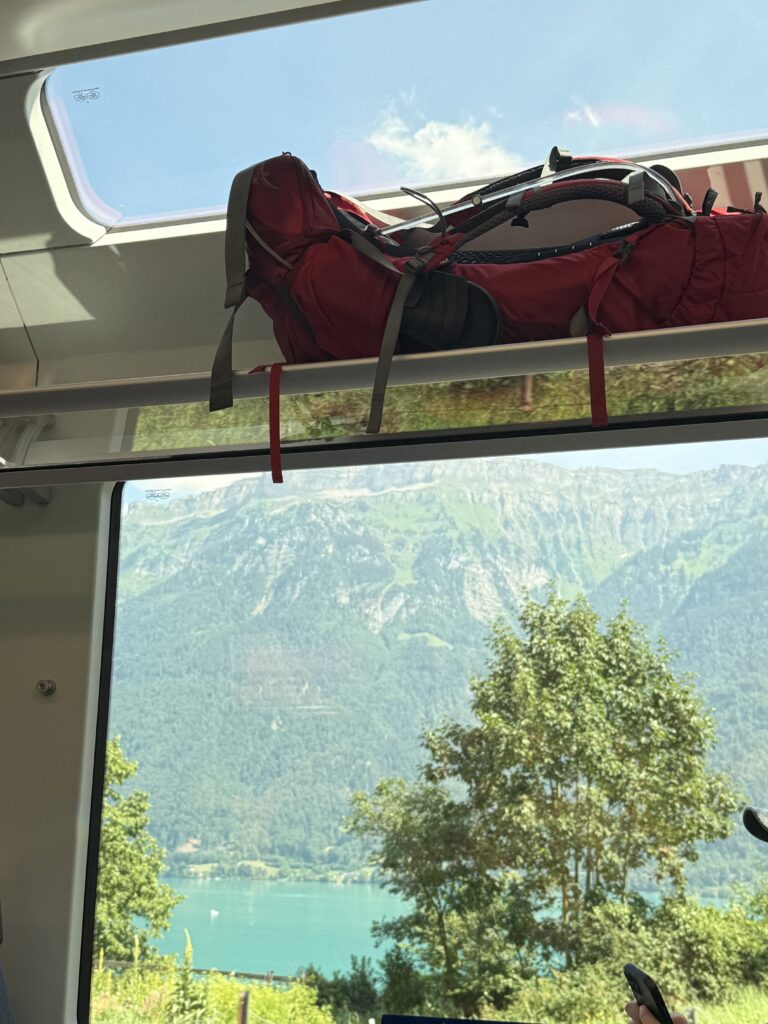
We took the bus for the final steep descent into Lenk rather than walking it (that would have been pretty steep). Six days in, that felt entirely reasonable. From Lenk, the trains back to Meiringen are straightforward and took us about 2,5 hours. We picked up the car, and drove home with some amazing pictures and memories!
What to pack
- A 40-50 liter backpack
- 2L of water (which you can fill at the huts)
- Hiking poles
- Lunch or snacks (or buy them at the huts you’ll pass)
GPX Route
I’m a big fan of Komoot, so here you can find the route with distance, time, height differences all-in-one for this hike: